Just yesterday, I made a photo trip along the Icefields Parkway, accompanied by my friend and fellow photographer, Bob Bear. We set out from Canmore at 7:00 am, travelling northwest on Highway 1 toward Lake Louise, before branching off onto Highway 93, the “Icefields Parkway”. It’s named for the expansive icefields and glaciers prominently visible as you approach the Town of Jasper.
Our purpose was twofold; we wanted to capture scenes of the spring runoff. Water is plentiful there at this time of the year. We also hoped to photograph another clear sign of spring in the Rockies, the thawing of the many lakes along our route.
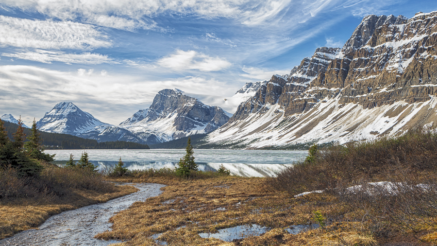
Our first goal was met early at our first stop, Bow Lake, about 1-1/2 hours after departing Canmore. This picture, featuring the lake, Crowfoot Mountain and the Crowfoot Glacier shows the demarcation between the ice cover on the lake and the open water near the shore.
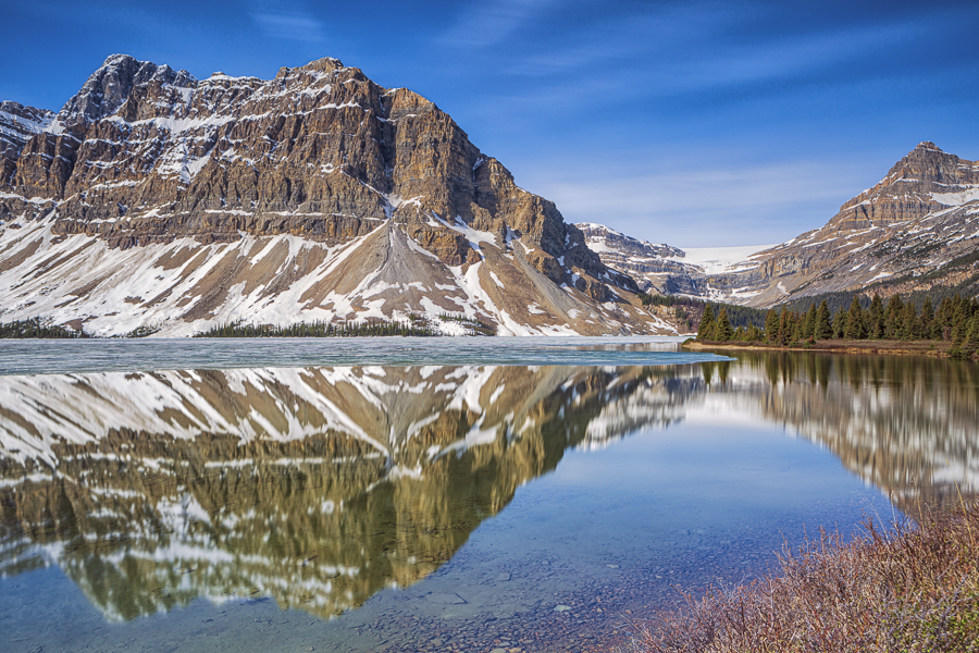
The next photograph, also of Bow Lake, was taken just ahead, at the lake’s edge looking to the right. Again, that’s Crowfoot Mountain on the left, reflecting beautifully in the open water. In the distance you can see the Bow Glacier, the source of water for towns and cities along the Bow River, including Canmore and Calgary.
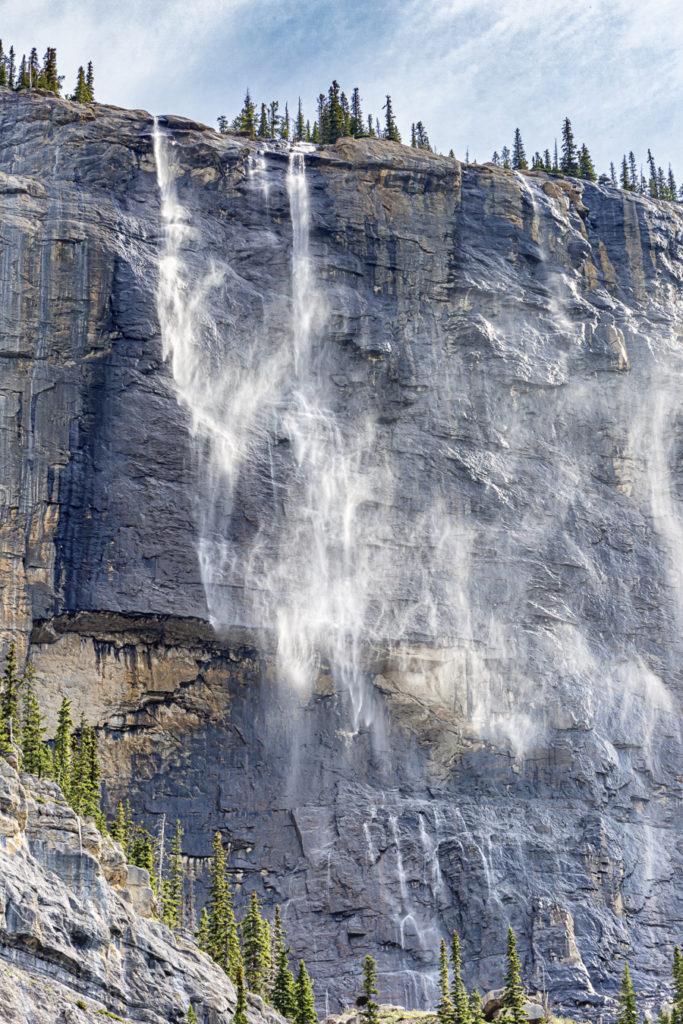
Our next stop was at the “Weeping Wall” named for the many waterfalls that plunge over this enormous cliff face at the base of Cirrus Mountain. The cliff is about 1,000 ft (305 m) high and immediately adjacent to the road on which we were traveling. Our timing was excellent, with the spring runoff close to its peak. A longtime Parks’ employee we encountered informed us that he had never seen such a prodigious flow over these cliffs. I chose to share this photograph which I found particularly eye-catching. A breeze had come up and was dispersing the wispy trails of water as they plummeted downward.
We were now making good progress with our second objective for the day, moving water. Our arrival at the “Weeping Wall” marked our entrance to “Waterfall Alley”, a section of the highway graced with numerous cascades.
We moved along our next stop, “Tangle Creek Falls” which also dropped close to the roadside. I elected to apply a little license to this scene, slowing the shutter to a 0.5 second exposure, creating this soft, silky appearance.

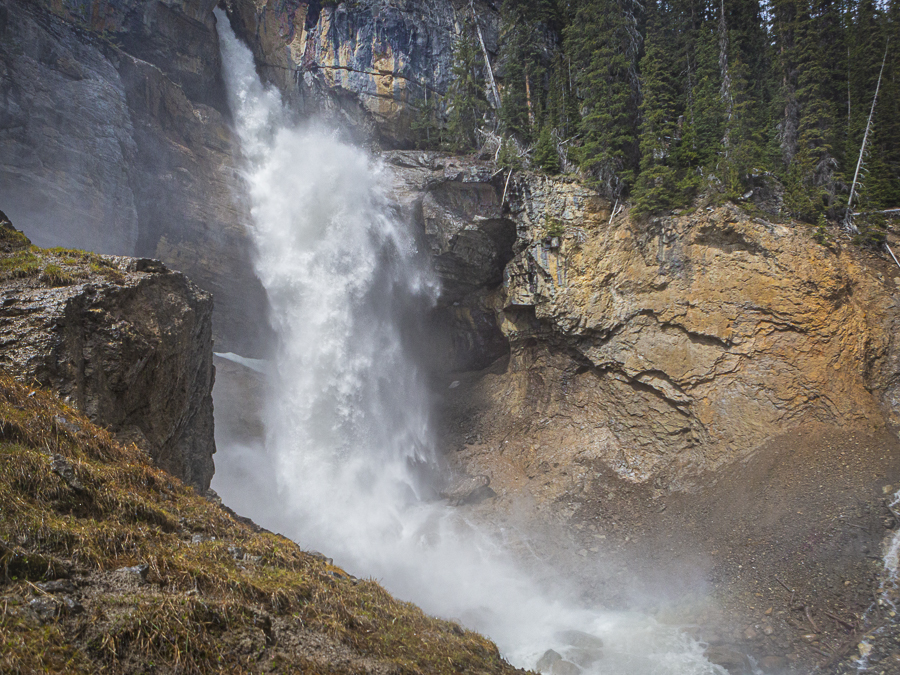
For those who might prefer a more turbulent looking waterfall, I’ve included this picture of Panther Falls. We walked in about 0.5 km to visit this somewhat hidden gem. Panther Creek emerges from a narrow channel though the rock. It’s flow of ~75 cubic feet per second then plunges 205 ft. (62 m.) to the rocky creek bed below. Needless to say there is a lot of splashing going on, making it challenging to get a photograph. It’s a matter of applying your settings, wiping the lens with your back to the falls, then pivoting quickly to fire a shot before then lens gets coated with water. Somewhat like an old west gunslinger. I was aided by the rapid shutter speed of 1/3,200 second. It was over long before the spray could get onto to the glass. This shutter speed “freezes” the action, creating an entirely different look to the flow of water.
It is possible to literally “freeze the action” by going in February as I did about 10 years ago. Look here if you’re interested in how the falls looked on that occasion…https://www.shotsbypeter.com/blog/?p=38
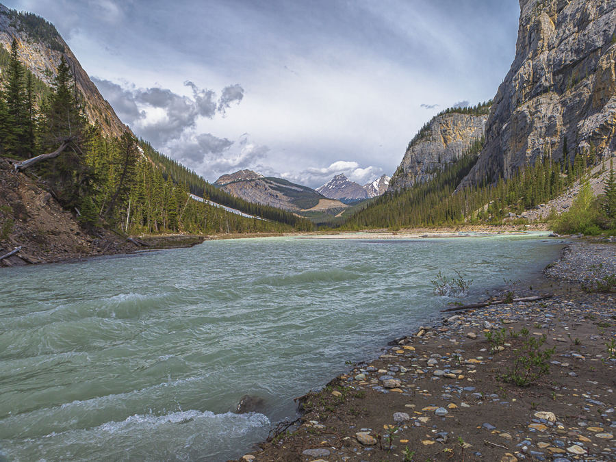
The last photograph for today features the North Saskatchewan River, captured across the highway from the “Weeping Wall”. It originates a short distance north at the Saskatchewan Glacier. It flows eastward into central Saskatchewan where it joins another river, becoming the Saskatchewan River and flowing into Hudson Bay.

Absolutely beautiful, you had an incredible day, love it…best of all an amazing reflection! Thanks Peter
Helen
Peter – these are just outstanding. Great work.
Beautiful, Peter. Love the pictures.
Murray
Hi Peter:
These are fabulous, you made the waters look magical and real.
Thanks for sharing.
Hi to Rolande
Karey
WOW!
Amazing pics!
We’ll have to take a drive and enjoy our
fabulous mountain scenery!