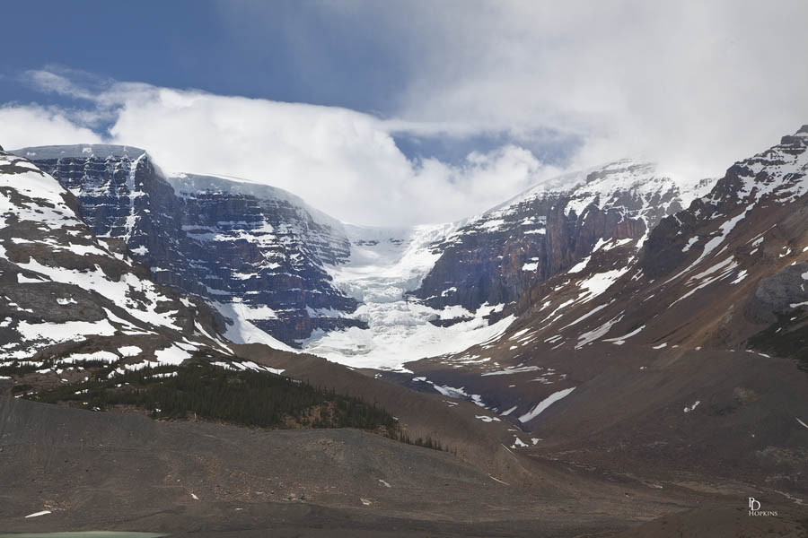
Yesterday, I made a brief visit to the Columbia Icefields Center, located on the Icefields Parkway between Lake Louise and Jasper, AB. I was accompanied by my cousins Paula, Valorie and Jennifer and their husbands Pat and John. While they made the trip onto the Athabasca Glacier, I took the opportunity to take a few pictures. My first picture in today’s post is of the Dome Glacier, located adjacent to the Athabasca Glacier.

The glacier is flanked by Snow Dome to the left and Mt Kitchener to the right. Snow Dome is located on the Continental Divide in the Columbia Icefield, at the intersection of Banff National Park and Jasper National Park on the Alberta and British Columbia border. The mountain was named in 1898 by J. Norman Collie because its snow-capped massif resembles a dome. The mountain, reaching a height of 3,456 m (11,339 ft), is a hydrological apex of North America. Water falling on Snow Dome’s summit flows into streams that drain into the Pacific Ocean (via the Columbia River), the Arctic Ocean (via the Athabasca River), and Hudson Bay (via the North Saskatchewan River). The Dome Glacier flows to the north-east, the Stutfield Glacier to the north-west, the Columbia Glacier to the west and Athabasca Glacier flows to the east of the mountain.
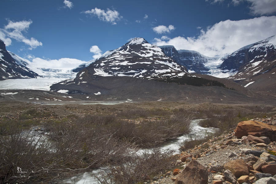
This second picture shows both the Athabasca and Dome Glaciers, visible from the Visitors’ Centre.

The Athabasca Glacier is easily the most famous glacier in North America. With easy access to the Icefields Parkway (Highway 93), more than 10,000 visitors pass by this river of ice every day in the summer. On busy days, more than 6,000 will take a trip on snowcoach tours. These specially designed 6-wheel drive vehicles take you 1.5 km (1.0 mi) out onto the ice where you can disembark and stand on 300 m (984 feet) of solid ice. The landscape is fabulous and the experience equally unusual.
As part of the Columbia Icefield, the Athabasca Glacier represents one of six major glaciers that flow off of this enormous accumulation of ice. In area, the Athabasca Glacier covers 6 square kilometres (2.5 sq. mi) as it stretches 6 km (3.75 mi) down the valley. Its depth varies from 90 to 300 m (270-1,000 ft). The glacier moves 125 m/year (400 ft) at the headwall, but considerably less at the bottom where the effects of the glacier’s receding is most evident.
