Yesterday’s photo destination was Field, British Columbia about an hour and fifteen minutes to the west. Accompanied by Bob Bear, I exited the highway and took the Yoho Valley Road, north into Yoho National Park. This road offers a number of splendid photographic sites, culminating with Takakkaw Falls at its northern end. Our goal was to capture as many as could. We soon realized that many of the sites feature a singular mountain that seems to dominate the landscape. Mount Stephen, 3,199 m. (10, 495 ft) in height is due south from where we traveled and very visible from many of the locations we explored.
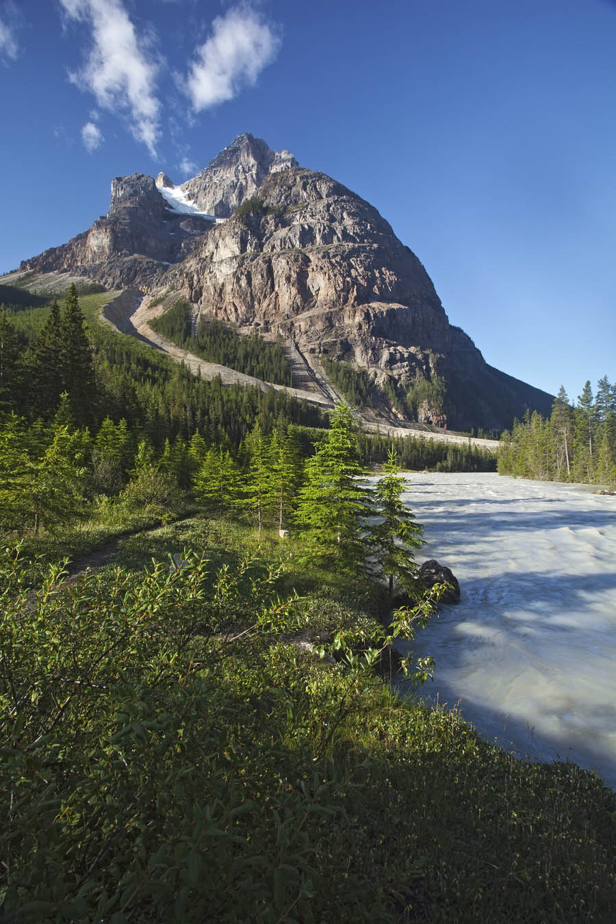
My first picture was taken just after we turned off, near the Cathedral Mountain Chalets. The picture features Mount Stephen with a glimpse of the surging Kicking Horse River. The Rockies are still experiencing the spring run-off so the rivers are running very high.
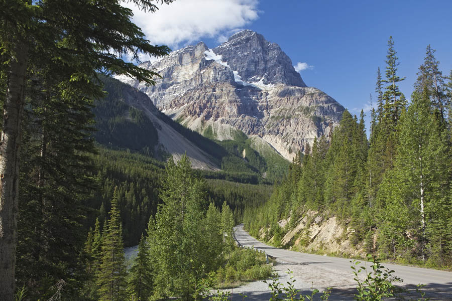
The next picture also shows Mount Stephen, this time from the Upper Spiral Tunnel Viewpoint. If you look at the base of the mountain, just above the road you’ll see a ridge. On the ridge are the railway tracks exiting/entering one of the spiralling tunnels bored through the mountains to extend the distance traveled and thereby reduce the grade that trains need to climb. Can’t see the tunnel entry? It’s not really very visible, likely due to growth of vegetation over the years. Nice spot to view Mount Stephen, though.
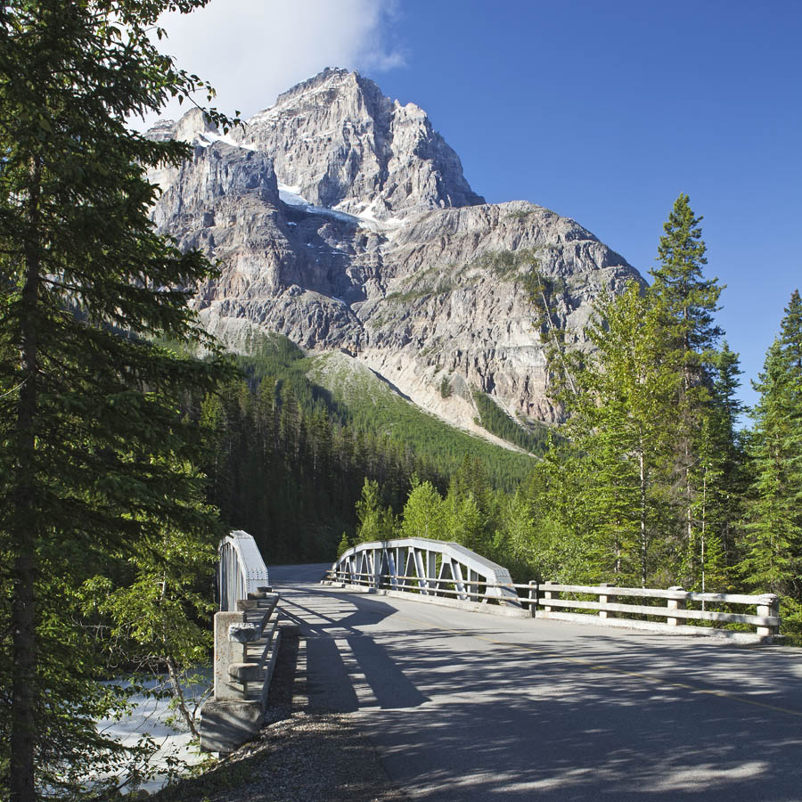
Okay, just one more with Mount Stephen in the background. This is the second bridge crossing the Kicking Horse River on the road north. I include this one because I find the old bridge a good photo subject and I like the way Mount Stephen looms in the background. When I said it dominates the landscape, I wasn’t kidding!
I think it is fair to say that the highlight of the day for us both was the “Meeting of the Waters” site. This is where two rivers, the Yoho and the Kicking Horse merge. The location is interesting in that the water colour is different for each river. The Yoho is milky white and the Kicking Horse is just very clear. The Yoho’s milky colour is thanks to the rock flour from the Waputik Icefield. Rock flour is fine powder ground by glaciers moving over rock. The powder is borne away by meltwater and finds its way into the rivers. The Kicking Horse River is more clear due to a series of small lakes on its tributaries which act as settling ponds for the silty glacial outwash. The Yoho is fed directly from the glaciers. For a distance after they two rivers merge, it is possible to observe the two different coloured streams flowing side-by-side. That’s true at other times of the year but not now. During the spring run-off, the huge volume of water produces a turbulence that blends the two rivers very quickly, leaving the combined stream (the Kicking Horse) a milky white. We were able to walk down to an excellent vantage point to view and photograph the confluence of these two rivers. Here’s my favourite from that location. You can see the difference in colour between the two rivers.
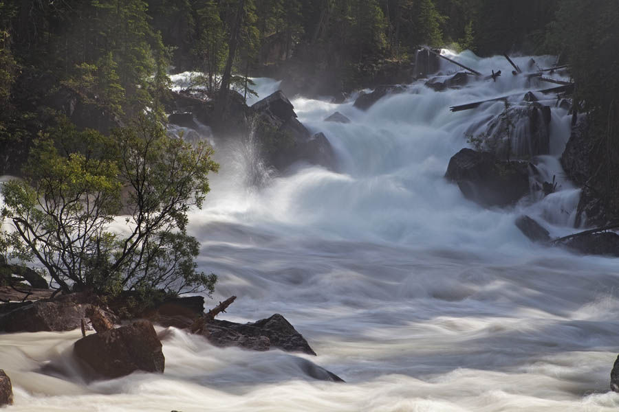
(I chose to slow the exposure to 6/10 sec. for this picture, using a 2-stop neutral density filter. That produced the softer look.)
My final two photographs are of Takakkaw Falls, looking spectacular at this time of year due to the high volume of water. Its highest point is 384 metres (1,260 ft) from its base, making it the second-highest officially measured waterfall in western Canada, after Della Falls on Vancouver Island. However its true “free-fall” is only 254 metres (833 ft).”Takakkaw”, loosely translated from Cree, means something like “it is magnificent”. The falls are fed by the Daly Glacier, which is part of the Waputik Icefield.
The first shot was taken at about 0.6 km away to capture the entire falls that are visible. Due to its height, you need to stand back a bit to get it all in! To get a good sense of the falls’ size, compare them to the trees on the right side slope near the bottom.
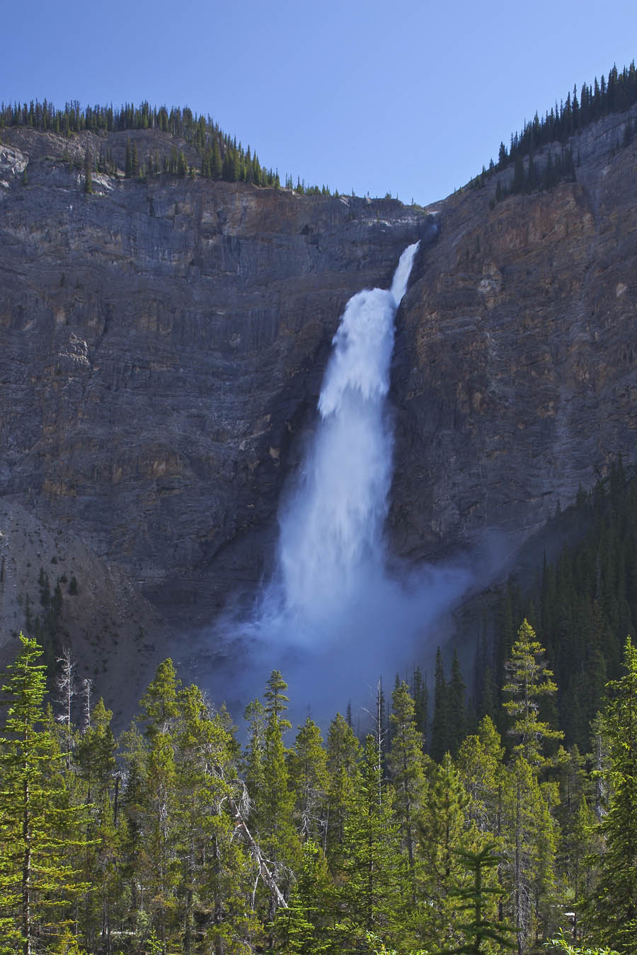
For the final shot, taken from the parking lot, I used a 70-200 mm telephoto lens to zoom in on the water launching off the ledge just below the top of the falls.
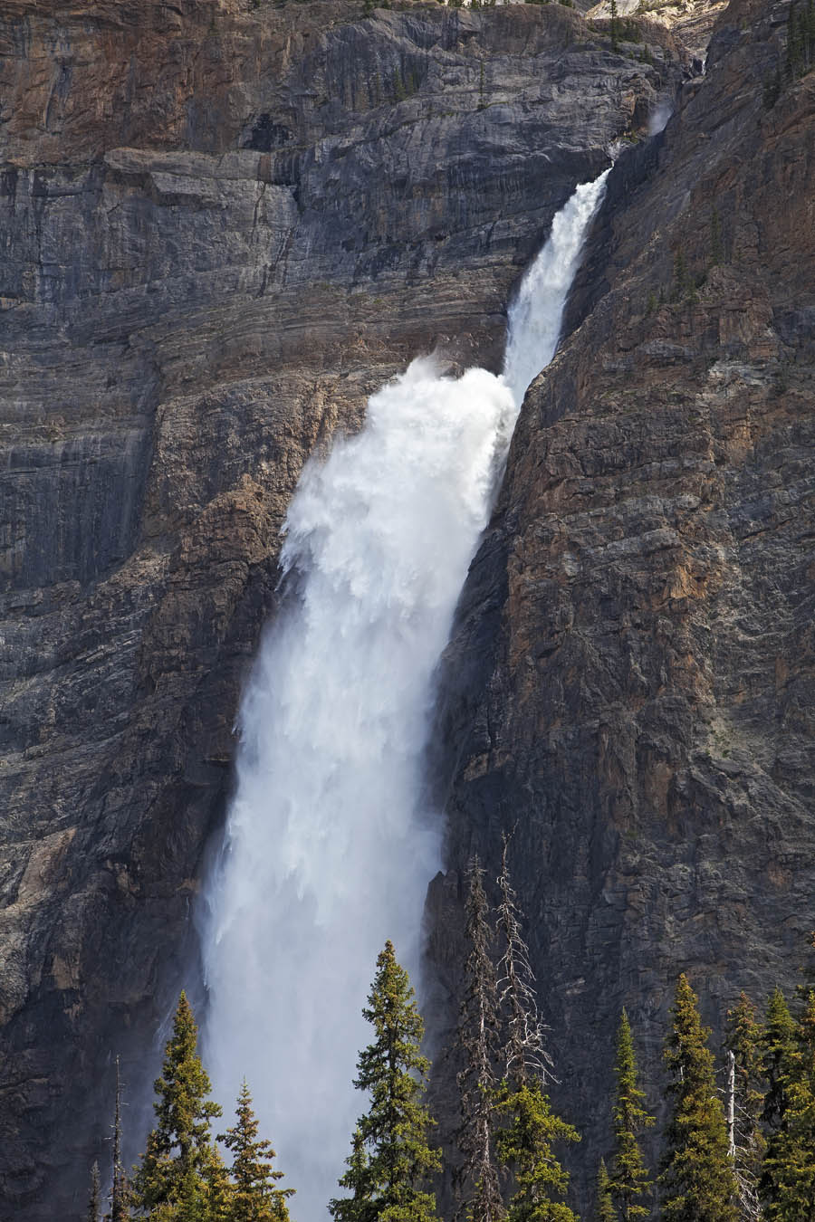
At other times of the year, it is possible to get closer shots of the base of the falls. Despite there being less water, it is still pretty impressive to see the water hitting the rocks after the long free fall. Right now, it’s pretty difficult. There’s water spraying everywhere within a hundred metres! Perhaps, I’ll return later in the year to try again.

Hello Peter,
Wonderful photos as usual. I enjoy seeing them very much. If you have the time to answer a question for me I would appreciate it. You referred to the technical criteria used for the photo of the two merging rivers. To quote, “I chose to slow the exposure to 6/10 sec. for this picture, using a 2-stop neutral density filter. That produced the softer look.”
I have never used a neutral density filter and always assumed the filters purpose only reduced the light (affecting exposure time)and not the sharpness or softness of an image. I was therefore unsure how the filter produces a softer look. I have tried looking on the net for an explanation but haven’t yet run across a satisfactory answer. If possible would you be able to explain why it softens an image? I apologize for my ignorance in this matter, but I asked the question because it could affect when, why or if I might consider using such a filter.
Thanks,
Jack
A good question, Jack. You are correct, a neutral density filter impedes light entering the camera and consequently lengthens the exposure. It does not alter the sharpness of the image; that is evident from those elements in the picture that are not in motion. The confusion arises from my use of the term “soft”. By “soft”, I mean the appearance of the water. The longer exposure produces this look (streaming) by recording the water’s movement over a longer period. By capturing this motion, the water’s appearance is somewhat blurred and as such looks softer. If I were to set the shutter to 1/1000 sec. for instance, I would get the opposite effect, freezing the motion and creating much sharper definition of the flowing water. Hope that helps.